Archifdy Ceredigion Archives
ACM: Early maps of Cardiganshire
Acc. 3392
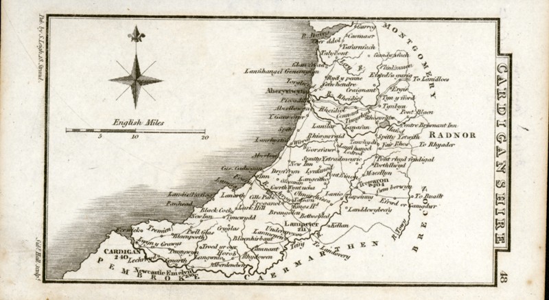
Ref: ACM/69-79MAPS BASED ON THE ORDNANCE SURVEYACM/69S. Leigh, 'Cardiganshire' (1830), engraved by Sidney Hall, shows principal routes, rivers and places.
Derives from same survey as ACM/70, lacking the eccentricities of ACM/64-68
14 x 8.1-3 cm
ACM/69 (1830)
Sheet No. 29 of
Cary's Improved Map of England and Wales (1832). Produced at a scale of two inches to the mile, this appears to be based on the surveyors' drawings produced between 1810 and 1833, which had not yet reached the north of the county, hence its eccentric representation. The map shows the old mouth of the Leri, whereas this part of the drainage of Borth Bog was carried out from 1824 and is depicted on the 1833 surveyor's drawing. Coloured.
The format of the map also appears to be based on Ordnance Survey practice, the south of the county being cut off so that this cannot properly be described as a county map.
The eccentric depiction of Ynys Lochtyn appears to be a misreading of the surveyor's drawing, missing its southern part so that the isle is placed rather askew to, and at a remove from, the main.
69.2-6 x 56 cm
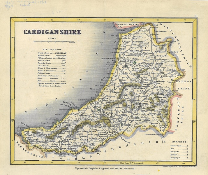
ACM/71R. Creighton, 'Cardiganshire', in S. Lewis
A Topographical Dictionary of Wales (1840/1843). Shows Union boundaries (with key), rivers, roads and principal places. Relief depicted with hachuring.
Reprint of an 1833 map (Lewis No. 58), derived from Cary's
Improved Map M.G. Lewis No. 60.
31.4-8 x 25-25.2 cm
ACM/72J. Archer, 'Cardiganshire', in T. Dugdale,
Curiosities of Great Britain and Ireland. England & Wales Delineated (1848), 'Engraved for Dugdales England and Wales delineated', at base. Shows (reorganized) hundred boundaries (with key), rivers, roads and principal places. Has Radnorshire in place of Pembrokeshire. Relief depicted with hachuring. Shows seats and parks as stippled blocks, following the conventions of Ordnance Survey one inch to the mile publications.
Possibly derived from ACM/71, but showing Ynys-Lochtyn as a promontory.
M.G. Lewis No. 61.
26.7-27.3 x 21.8 cm
ACM/73J. Archer, 'Cardiganshire', in T. Dugdale,
Curiosities of Great Britain and Ireland. England & Wales Delineated (1848). 'Engraved for Dugdales England and Wales delineated', at base.
Same as ACM/72
M.G. Lewis No. 61.
26.4-8 x 21.6-8 cm
ACM/74J. Archer, 'Cardiganshire', in T. Dugdale,
Curiosities of Great Britain and Ireland. England & Wales Delineated (1848). 'Engraved for Dugdales England and Wales delineated', at base. Coloured.
Same as ACM/72
M.G. Lewis No. 61.
26.1-3 x 21.9 cm

ACM/74 (1848)
J. Archer, 'Cardiganshire', in T. Dugdale,
Curiosities of Great Britain and Ireland. England & Wales Delineated (1848). Coloured.
Same as ACM/72, but lacks 'Engraved for...' at base.
M.G. Lewis No. 61.
26.1-2 x 21.8 cm
ACM/76Map of the South-west Circuit of the Principality of Wales comprising the counties of Cardigan, Pembroke and Caermarthen from an actual survey made in the years 1832 and 1833 by C. & J. Greenwood... published April 1st 1834'. Electoral districts delineated and places of election listed. Engraving of St David's cathedral bottom right.
Based on same sources as
Cary's Improved Map of 1832 (ACM/70).
81 x 65.1 cm
ACM/77R. Creighton, 'Cardiganshire, Sir Aberteifi' in Gweirydd ap Rhys
Hanes y Brytaniaid a'r Cymry (1872). Shows Union boundaries (with key), railways, rivers, roads and principal places. Relief depicted with hachuring.
Reprint of an 1833 map (Lewis No. 58; see ACM/71 above)
M.G. Lewis No. 70.
26 x 19.7 cm
ACM/78Robert K. Dawson, 'Aberystwyth, enlarged from the Ordnance Survey', in
Report of the Commissioners … Boundaries and Wards of certain boroughs and corporate towns (England and Wales) (1837). Shows present and proposed municipal boundaries in contrasting colours. Accompanying text, on separate sheet, by H.R. Brandreth, 'Aberystwyth, Report upon the Proposed Municipal Boundary of the Borough of Aberystwyth'.
M.G. Lewis No. 90.
33.8 x 20.4-8 cm
34.2-4 x 20.8-21 cm
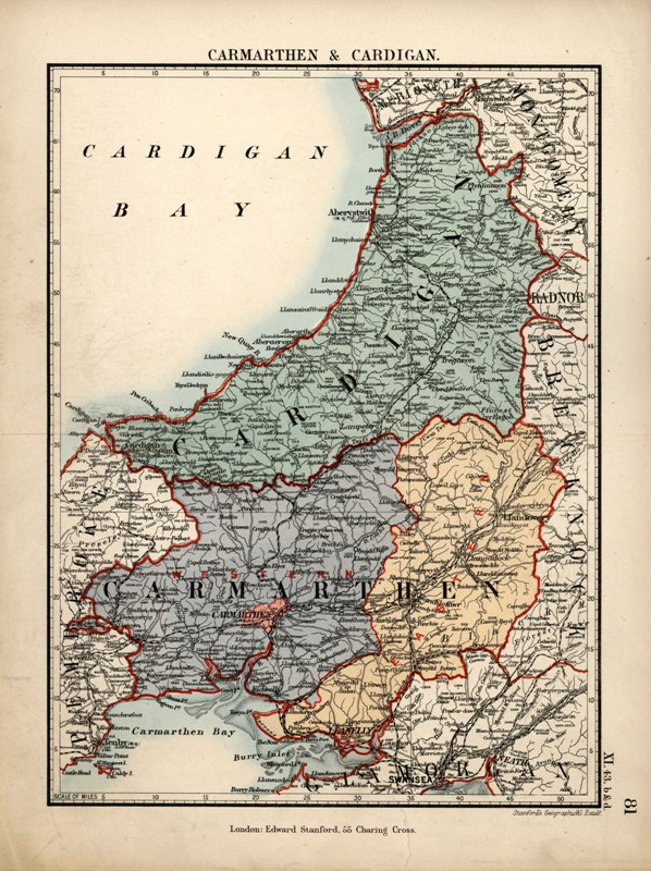
ACM/79'Carmarthen & Cardigan', 'London: Edward Stanford, 55 Charing Cross', 'Stanford's Geographical Estabt.' Top right, '81' and XI.43. b 7 d'. Shows railways and new cut of the Leri. Date 1885 pencilled on reverse.
Based on Ordnance Survey.
28.1 x 21.5 cm

ACM/79 (1885)